ANGLER: Neil Scibelli
TAG ID: GFR44932
SPECIES TAGGED: Bass, striped (Morone saxatilis)
LOCATION: Rye Harbor, New Hampshire, USA
DATE: 08/04/2022
RESEARCH CENTER: The Fisherman Magazine
BOAT NAME: Harvester Fishing Charters
CAPTAIN NAME: Peter Aikens
MATE 1 NAME: Tommy Jolly
ORIGINAL ANGLER INFORMATION:
ANGLER: Greg DeMello
DATE: 12/30/2021
LOCATION: Toms River, New Jersey, USA
RESEARCH CENTER: The Fisherman
BOAT NAME: Andrea’s Toy
CAPTAIN NAME: Greg DeMello
CATCH DATA:
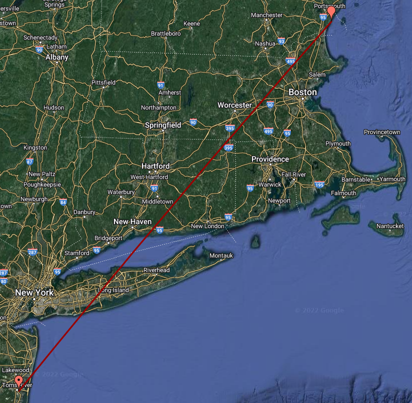
OCEAN: Atlantic
Lat/Long of Deployment:
LATITUDE: 39.944499
LONGITUDE: -74.175017
Lat/Long of Recovery:
LATITUDE: 42.98467
LONGITUDE: -70.74360
![]()
FISH CONDITION: Fair
BAIT USED: Live Bait
TOTAL LINEAR NAUTICAL MILES: 239 (straight line) nautical miles
DAYS AT LARGE: 217 days
ESTIMATED SIZE & WEIGHT: 7 lbs
ADDITIONAL REMARKS: Tag recorded and fish was released. It was gut hooked but released great.
*Dotted point represents the original tagged location*
(Map pins indicate original and recovery locations and does not reflect fish exact movements)